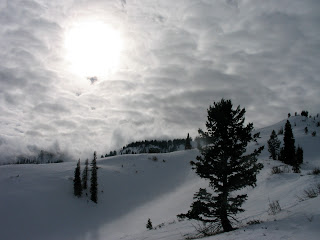
I liked this lonely tree.

The views were lovely on the way up.

And I kicked off a couple of cornices to see how sensitive they were. They were hard, but failed withing two or three good kicks.

I ended up meeting up with two guys, Chris and Kevin, higher up on the ridge that I new were out touring in the area. So, after checking out the snowpack and deciding on a plan, we dropped in to find 3-4 inches of creamy fast powder on top of a supportable base. Chris drops in.

And makes nice turns a little lower down.

It was a great day to be out in the mountains and see what the last week's weather had done to the snowpack. It is certainly gaining strength, but there are still spots out there where if you triggered something it would be really bad. So we chose to play it safe. There's no snow in the forecast for the next week as a big high pressure system sits over Utah. This should help to continue strengthening the snowpack as it will be quite warm. We might even have a mid-January corn cycle by next weekend.

No comments:
Post a Comment